This was one of the first ones I saw it is a 3/4" smooth rod set in a rock outcrop at the corner of a street. Since this whole island is one gigantic rock this probably is not uncommon.
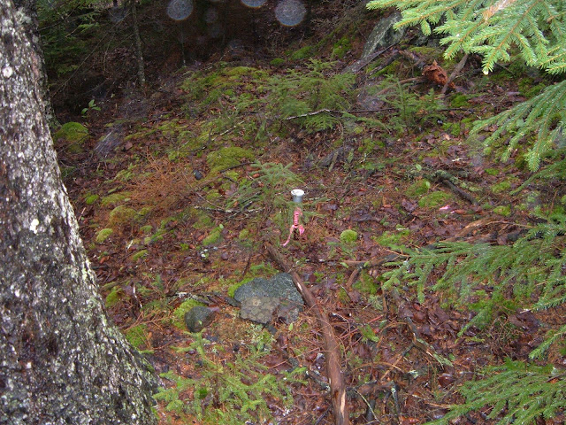
Rebar with plastic cap sticking out of the ground about a foot....probably hit solid rock! Most of the marker I saw on the island were like this. However...I did see some on the mainland that were like this so it may be local custom.
This 5/8" rebar with plastic ID cap was set by Michael D. Falla, Maine PLS2364
This is a bell monument at the top of the hill near the Monhegan lighthouse. You can see a brass tri-station mark in the foreground. Didn't notice this until I published this post but you can also see Tami's shoe in the left side of the photo...
This tri-station appears to be set by the US Navy. I couldn't find it in the USGS database. USGS Station "Monhegan Light", PID OB0378 states:
STATION RECOVERY (2004)
 OB0378
 OB0378'RECOVERY NOTE BY US POWER SQUADRON 2004 (LM)
 OB0378'RECOVERED AS DESCRIBED. ALSO FOUND A STANDARD DISK IN GRANITE LEDGE
 OB0378'APROXIMATELY 80 FT SW OF LIGHT MARKED MON 1961
View from 6'
The views above and below are of what may be a marker on the line between Lots 4 and 5 (refer to AS article, map on page 5) near where the trail crosses the line leading to the "Seal Ledges" (where...by the way I did see about 20 seals..). It is a 3/4" smooth bar set in a bore hole and has the appearance of being very old. You can see how close this marker is to the trail.
The views above and below are of a 5/8" rebar with aluminum ID cap set by Robert C. Clunie, Jr., PLS1213. Found this on the north end of the island out in the timber near the marker found above
Plastic ID cap on a 5/8" rebar set by Mark H. Daiute, PLS2129
1" pipe survey marker
Another 5/8" rebar with plastic cap.
This is a USCGS benchmark marked "No. 3 1945". No info about this in the USGS database but according to the info on the cap you can write to the USCGS in Washington DC for it. This benchmark was about 50 ft from the dock on the north side of the road.


No comments:
Post a Comment
You Comment - I Moderate